
 Phil and I have decided that whilst we are in Kenya, we are going to climb Mount Kenya, an extinct volcano and the second highest mountain in Africa. We live in the shadow of this mountain and we see its glory on almost a daily basis so what better than to get up close and personal with this magnificent entity. Phil has already climbed Mount Kilimanjaro, the highest peak in Africa so he is keen to tick off another challenge. This will be my first attempt at climbing a mountain but I look forward to the adventure.
So in preparation for our mountain climb, we went for a walk up the mountain by way of training, and to test our kit. Mount Kenya lies within Mount Kenya National Park and was named as a UNESCO world heritage site in 1997. It can be found around 16.5km south of the equator within Laikipia, is approximately 5199 metres and has three peaks, namely Batian (5199m), Nelion (5188m) and Lenana (4985m). We are to climb Lenana. There are three main routes up the mountain: Chogoria, Naro Moru and Sirimon. In order to scale the peak of Lenana we found out on our training day that we are to use the Sirimon route, via Sirimon Gate which is around 2500m.
We entered Mount Kenya National Park at Sirimon Gate where we were greeted by the dense Yellowwood Forest, and we were treated to some of the wild life that resides within the national park, and in the foothills of the mountain. We saw buffalo and baboons on our drive up to Old Moses Camp, where we were to alight our vehicles and commence the hike up the mountain.  The mountain is home to leopard, rock hyrax, many antelope species, and within the forests at the base of the mountain can be seen elephants, buffalo and black rhinoceros. Mount Kenya National Park extends to Ngare Ndare Forest and Lewa Conservancy which act as elephant corridors, allowing the migration of elephants so they are frequently seen in and around the mountain, although we did not see any on this particular day. We were informed that the Sirimon route is the least used out of the three routes but it features a gradual ascent and obviously passes through the forest.
As we drove higher and higher towards Old Moses Camp, the landscape changed with the altitude. The landscape on Mount Kenya is impressive with its glacier clad summits, the middle slopes are dense with forest but higher up, generally above 3000m, the terrain becomes typically alpine with a diversity of ecosystems including grassy glades, moorland, tussock grassland and sedges. Above approximately 4500m, the vegetation ceases and the terrain is decidedly more craggy and rocky as I am sure we will see when the climb is undertaken.
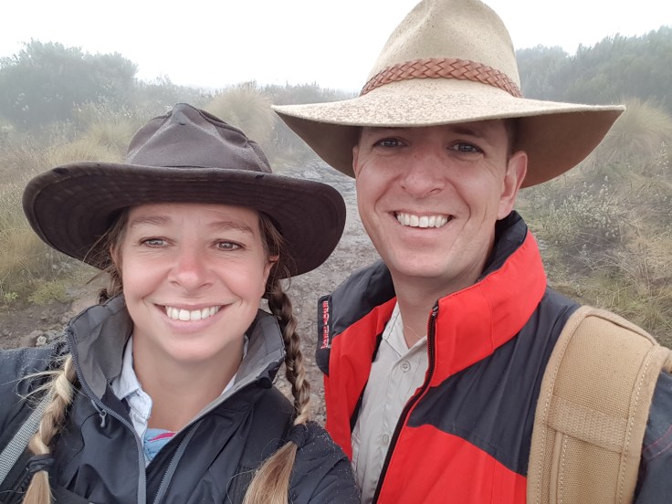
As we commenced the walk, it was immediately obvious to me that the altitude would be a big factor. Whilst the scenery was utterly breath taking, so was the altitude and our pace was kept slow and steady. 
Phil was not as surprised as I was, and managed to maintain that slow and steady pace with ease, having learnt from his experience on Kilimanjaro that altitude can be life threatening and cause real difficulties. As we slowly hiked up the mountain, we were able to take in the rugged beauty of this wild landscape. The wildlife disappeared the higher we got, but the landscape remained impressive with craggy rocks, the alpine vegetation, the rolling and eerie mist and the meandering streams.  The rivers that start on Mount Kenya are the tributaries of two large Kenyan rivers, namely the Tana and Ewaso Ng’iro.
Whilst on the mountain, it was easy to appreciate why the Kikuyu people of Kenya (and the related Embu and Ameru people) revere it as the home of their omnipotent deity ‘Ngai.’ The fertile lower slopes of the mountain are cultivated by the Kikuyu people as well as both Embu and Ameru people. The Maasai people who are semi-nomadic also use the land to graze their cattle. The Kikuyu people form the largest ethnic group in Kenya, some 20% of the population, and they refer to the mountain as ‘Kirinyaga’ (or ‘Kere Nyaga’) which translates to ‘Mountain of Whiteness’ and they believe that the mountain is Ngai’s throne on earth. The Maasai call it ‘Ol Donyo Keri’ which translates to ‘Mountain of Stripes’ probably because of the layers of differing landscapes – the dense forests, the alpine terrain and the snow and glacier clad summit. 
Despite the intense African sun, apparently snow can be encountered any time of the year, even in the height of the summer months in January and February. Phil and I will be climbing the mountain in January and whilst the snow can be stunning, I can’t say that I am a fan of the cold weather. That said, global warming is said to be having a significant effect on the glaciers. In around 1890, there were 18 recorded glaciers but at least 7 have completely disappeared and the remaining glaciers are shrinking.
Phil and I enjoyed the hike up the mountain in preparation for the real climb in the future. We got to around 3750m, over half way up and the landscape was stunning so we can’t wait to do the real thing and complete the climb to reach the summit.
#weloveachallenge #watchthisspace#africanadventures

Leave a comment